Somehow, it seems as if quite a few of my friends are posting pictures on Facebook
this week of trips that they took 1, 2, 3 or more years ago. It's enough to make me
nostalgic too, harking back to my tour of the Canadian Rocky Mountains 9 years ago.
On this trip I encountered a breathtaking clear and sunny day for my round trip drive from Jasper to Lake Louise and return, on Alberta Highway # 93, which is called the "Icefields Parkway." It's an appropriate name because the highway exists mainly for tourism, and while one does encounter a few trucks they remain few and far between. Big campers, on the other hand, are frequent (no surprise).
The Parkway has been aptly called a "national treasure", and it certainly is no less than that. I pity all the people who gallop east or west across the mountains, and miss this north-to-south chain of breathtaking natural miracles.
Here's a map of the Parkway as published by Parks Canada (easy to find online if you want to be able to pick out all the fine details):
I left Jasper right after breakfast, and with all the numerous stops along the road for the incredible scenery and for taking photographs, I didn't get to Lake Louise until well after noon. I "shot the works" by using the valet parking at the Chateau Lake Louise and eating lunch there, in a bay window overlooking the lake, while a harpist played gently in the background. After a walk along the lake shore, I returned north, and realized something I hadn't quite understood before. The mountains all looked different with the sun striking them at different angles and changing the arrangement of light and shade. So I had to do a few repeat pictures on the way north. And I was back at Jasper by dinner time.
So with that, here's an album of some of my best pictures from that day-long round trip. First, the drive south, beginning with the morning fog lifting away.
These two pictures show the Sunwapta and Athabasca Glaciers, both of which pour down from the edges of the gigantic mountain top Columbia Icefield that gives the Parkway its name.
The southern half of the road, from the Icefield back down to Lake Louise and Banff.
A characteristic mountain river in a glaciated valley -- one look will tell you why geographers call this a "braided" stream. All those sand and gravel bars have been eroded down from the surrounding mountains by the running water through thousands of years.
Saskatchewan River Crossing has one of the several service areas along the road.
Peyto Lake is the largest lake which you will see along the Parkway. The milky green colour is typical of glacier-fed lakes and is caused by fine-ground silt suspended in the water.
Bow Lake with the Bow and Crowfoot Glaciers. This lake is the birthplace of the Bow River which flows through Banff and Calgary.
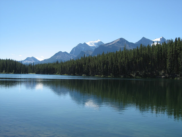
Herbert Lake is plainly non-glacial, as you can see through the clear water. Lake Louise is just around the corner behind the nearest ridge of mountains.
The view at lunch in the Chateau Lake Louise was even more spectacular than the prices (but only just!). Rooms at this iconic resort hotel run from $600 to $900 a night all year round, with the highest prices for the rooms with the lake view. Meals are not included in those prices.
On the way back north, I stopped for a bit of a hike at Mistaya Canyon. It was a long, very steep climb down the mountainside trail from the highway to the edge of the canyon, especially challenging with my bad knee, but it was worth every second of the effort.
North of Saskatchewan River Crossing, as you approach the Icefield and Sunwapta Pass, the road zigzags up the sharp headwall and then you get this amazing view back down into the Saskatchewan River valley.
And finally, one last snow-capped mountain view.


