Showing posts with label history. Show all posts

Friday, February 20, 2026

Europe 1975: A Throwback Memory

I've been travelling independently for well over half a century. From my earliest trips, I have scattered memories of incidents here and there. This week, I got hit out of left field by a memory from my first independent trip to Europe in 1975, thanks to Instagram's random selection of stories that the software thinks might interest me. That picture so intrigued me that I promptly went digging for more. Here's the photo that IG turned up for my consideration -- a rather unusual sight by anyone's standards.


Let's face it, it isn't every day that you see a passenger train charging across the apron at an airport terminal. The location was the airport at Le Touquet - Paris-Plage in northern France, right on the coast of the English Channel south of the ferry ports at Calais and Boulogne. The scene was the transfer point between two legs of an unusual rail-air hybrid service that used to connect Paris and London three times a day -- "The Silver Arrow."


Since this was 1975, there was of course no Channel Tunnel to speed up rail travel between the two capitals. The available options were using rail at each end to connect with the ferries across the Channel from Calais and Boulogne, or to fly from Paris (Orly or Le Bourget) to London (Heathrow or Gatwick). The all-air option was fearfully expensive, while the traditional ferry crossing would take 5 hours or more (including train times) and laid you open to the notoriously rough seas of the English Channel, one of the most seasick-prone sea crossings on the planet.

I'd just spent four weeks touring on the continent, and would soon be heading back to England for my flight home when I saw an ad (while browsing a bookstore) for the Silver Arrow. I had a vague memory of having heard of it earlier, but wasn't aware of the details. However, the price was right and I booked it with no hesitation, having had my own baptism by rough water when crossing the North Sea from England to Norway several weeks earlier (that ranks as one of the most miserable travel experiences of my entire life).

The journey began at the Gare du Nord, the same station in Paris where Eurostar expresses now depart for London via the tunnel. The train, shown in the first photo at the top, ran express to Le Touquet with only a single stop in the northern city of Amiens. As we approached Le Touquet, the diesel train left the main line on a branch. This ran north-westwards into the airport property, crossed two active taxiways, and then curved around to west and ran right across the apron into a station platform attached to the end of the small airport terminal. The track across the airport has been paved over now, but you can still see traces of the route today on aerial photographs marked here with several "silver" arrows!

As we were rolling into the airport, I was seated on the right-hand side of the train, and so completely missed a grandstand close-up view of the aircraft as we rolled in.


Considering that this train would go no further than the airport before returning to Paris, it was far bigger than any possible need. The plane only seated fifty people; the train probably had space for three times that number. And indeed, the train had loaded up with the inbound passengers and departed back to Paris before we'd even boarded the flight.

Check in went very quickly, and so did the security check. And then we walked out to the plane. Ah, the good old days!

The name of the airline was British Island Airways, one of a sizable collection of independent airlines in the British Isles which flew smaller turboprop aircraft like this one in and out of smaller airports at various cities beyond the big metropolitan centres of the United Kingdom. The aircraft was a real rarity, one of a number of aircraft types produced in the 1950s and 1960s by the British civil aviation sector which saw only limited service with non-British airlines. This one is the Handley Page Herald. It was one of several different types built at the same time by various British manufacturers, all seating around 50 passengers, and all powered by the ubiquitous Rolls-Royce Dart turboprop engine. The Herald struggled to make sales, and only 50 of these aircraft were completed.

Oddly enough, one Canadian airline operated the Herald around the same time period. Eastern Provincial Airways, the regional airline of the Maritime provinces, operated this type into a number of smaller airports from their main hub at Halifax.   

The two pictures shown so far were of BIA's final colour scheme, so they must have been taken a few years later on, perhaps on one of the final runs of the Silver Arrow. Here's one more picture which dates from an earlier year and shows the colour scheme as it appeared on my flight. 

Attribution:  

Once we were all aboard and seated (and the plane was not full), the engines were fired up with that memorable plaintive whining tone unique to the Dart engines, and we taxied quickly out to the runway. It was a beautiful sunny day, and the flight to London Gatwick airport took only 35 minutes, a great advance over the 90-minutes-plus that a ferry would take from Calais to Dover. We flew at a fairly low altitude and had a great view.

Why Gatwick? London Gatwick had a feature that was nearly unique in 1975, although it's now seen as more or less essential in Europe and much of the rest of the world. This airport had direct rail access to the city with a station on the main line from Brighton up to London Victoria. Once we deplaned at Gatwick, it was a quick walk through the terminal, across the footbridge over the tracks, and down to the platforms. Our ticket included travel on the premium-priced Gatwick Express service which ran into London nonstop in a matter of 35 minutes.  

I was saddened a few years later to find out that the Silver Arrow was no more. It wasn't the Channel Tunnel that caused the demise of this unique service -- that still lay years in the future. It was something completely different in the world of ferries.

 Photo credit: Andrew Berridge, CC BY-SA 2.5 <https://creativecommons.org/licenses/by-sa/2.5>, via Wikimedia Commons  


Photo Credit: Bachcell, CC BY-SA 3.0 <https://creativecommons.org/licenses/by-sa/3.0>, via Wikimedia Commons
 
These monsters, the SRN-4 hovercraft, could carry 450 passengers and 100 cars at a time, "flying" across the waters of the English Channel a short distance above the waves, and (most significant) were capable of crossing in wave height conditions up to 3.5 metres (11.5 feet). The hovercraft service was already in existence in 1975, and I admit it was a tough choice, but the unusual aircraft won out over the exotic hovercraft. I never did get a chance to cross the Channel in this way. Pity.


Friday, May 9, 2025

European Circle Tour # 11: Sailing Into Lisbon

Our final port of call before the end of the cruise was in Lisboa (Lisbon), the capital city and biggest port of Portugal. While Lisboa's history is believed to date from centuries before the beginnings of Christianity, back to the arrival of the Phoenicians, there's very little to see today that's any older than 1755, except in the old hilltop Moorish district known as Alfama. That's due to the great Lisbon earthquake which combined a massive tremor with a 20-metre or higher tsunami to destroy almost all of the city.
 
All of Lisbon's long and rich history goes to make this one of the most beautiful cities in the world to arrive in by sea. This first post of two for our one-day port call takes you through the approach by the Emerald Princess up the broad estuary of the Tagus River (spelled as "Tejo" and pronounced "Teh-zhu" in Portuguese). This approach is a truly remarkable experience which land-based tourists can never share. Our sail-in was blessed by uncommonly beautiful weather in the late morning.
 
Coming in from the ocean, you pass by extensive areas of modern apartments and industries. The first notable landmark comes right at the point where the estuary narrows down dramatically. This is the famous Torre de Belém, seen from angles that visitors on land can never get.


As the wide river mouth narrows down, it's a natural spot for the small boat to come out to meet the ship, bringing the harbour pilot to guide us in. Here's the pilot boat heading back to shore. The modern, angled building the boat is heading towards is the headquarters of the port authority. It's slanted at even more of an angle than this view makes it appear. Take that, Leaning Tower of Pisa!
 

Right at this point, we pass the famous Monument of the Discoveries. The people  standing around and looking up at it give you a good idea of the size of this sculpture.
 

Just past the Monument, you get periodic views of the Mosteiro dos Jerónimos, a landmark religious site and museum.
 
 
All this time, the view ahead of the ship has been dominated by the 25th of April Bridge. The bridge was originally named after the man who commissioned it, the dictator António Salazar. The name change came after the remnants of Salazar's Estado Novo regime were overthrown in a bloodless coup six years after his death, an event now celebrated each year on the 25th of April as Liberation Day, but also popularly referred to as the Carnation Revolution. The bridge was the first fixed crossing of the Tagus, and carries both road traffic on the upper deck and trains on the lower deck.
 
As we approached the bridge, the air was filled with a strange, unearthly humming sound which got louder and louder as we drew nearer, sounding reminiscent of the weird chanting music from the light show in 2001: A Space Odyssey.


It's caused by the sound of car tires on the two centre lanes of the bridge, which consist of open steel grid decking rather than solid pavement. It's a feature that makes a long suspended span like this much less resistant to wind and therefore less likely to sway dangerously in stormy weather.
 
After passing the bridge, we drew nearer to the centre of the city and the dramatic Praça do Comércio, as much the monumental centrepiece of Lisbon as the Arc de Triomphe is of Paris. 


Beyond the plaza, we come to the hilly Alfama district. The summit of the hill is marked by the fortress of São Jorge (Saint George). Among the crowded streets, you can pick out what looks almost like another fortress, the twin towers of Lisbon's cathedral. The far end of the hilltop is crowned by the monastery church of São Vicente da Fora. Nearby stands the proud, tall dome of the Panteão Nacional, burial place of famous and notable people.


And it's right at this point, just below the Alfama, that the ship arrives at the sizable cruise terminal and ties up to the pier below the Panteão Nacional. Welcome to Lisbon!
 
I didn't actually spend any time in Lisbon on this visit, opting instead for an out of town tour to the west, visiting the unique historic town of Sintra and beach resort of Cascais. That visit will be covered in the next post. For those interested in a detailed look at the city itself, here's a link to the blog post from my first visit to Lisbon, back in 2022. Enjoy!


Wednesday, May 7, 2025

European Circle Tour Part 10: The Not-so-Solid Rock

Remember the slogan, "Strong as the Rock of Gibraltar"? Thank you, Prudential of America, which no longer uses such slogans but still keeps its corporate logo with a stylized picture of the famous Rock. The logo is based on a picture showing the Rock as seen from the north end and looking down the east side.
 
Here's how it looks from the cruise terminal on the western shore, which is where you find most of the people and all of the shipping facilities. It was still early morning, but unlike my last visit, the entire western face of the Rock is pretty much visible. The weather got much clearer as the day went on.
 

Our guide, a long-time Gibraltarian like most of the tour guides here, related how many visitors will ask questions like, "How many people live on the island?" Since there is ocean everywhere you go, it's easy to forget that Gibraltar is attached to the mainland area of Spain. A reminder: here, just across the Bay to the west is the Spanish port city of Algeciras.
 
 
Here's a map to help you see the whole layout of the Rock and the Straits area.
 
 
For myself, I got a bit of a chuckle out of a member of our small tour party who kept asking, "Where is the Rock? When do we see the Rock?" It took him a fair chunk of the morning to finally catch the concept that we had been driving and walking all over the Rock for the entire time. 
 
In ancient myth and lore, the prominent limestone crag of Gibraltar was renowned as one of the two "Pillars of Hercules." The other, a much taller mountain called Jebel Musa (the Mountain of Moses) is on the south side of the strait. The two Pillars are marked on the map with the red blocks.
 
Since it's all limestone, the Rock of Gibralter is very porous, full of natural cracks and crevices and caves. Many of these were expanded by British Army Engineers during the centuries since Gibraltar came under British control in the early 1700s as part of a peace treaty. More tunnels were excavated during World War II, and still more opened up since the end of the war. The latest one is a tunnel that plunges down under the single runway of Gibraltar airport (which is parallel to the border with Spain), coming up on the other side in Spain itself. Last time I was here, the highway link to the Spanish border was still on ground level, right across the runway, and had to be closed every time a plane landed or took off!
 
Our ship itself encountered a similar problem when we were ready to depart at 5:00pm. The problem: there was a plane scheduled to take off right about that time, and it was basically impossible for the ship to move and pivot away from the pier without getting right into the flight path and just off the end of the runway -- which is actually extended into the ocean on both sides of the peninsula. Wherever you go in Gibraltar, space is always at a premium and the damn Rock keeps getting in the way!
 
Most of the highrise buildings you see in my photos are built on filled land. More fresh land is being created all the time (our guide showed us another rock-fill project just beginning). The only way for Gibraltar to grow is for the land mass below the Rock to expand. In this picture, you see two ships at the cruise port, some highrise apartments on the newer part of the reclaimed shoreline, and a plane lifting into the air from the runway (look at the cropped second picture to zoom in on the plane).


Our tour began with a scenic drive all around the Rock, with a couple of brief stops for photos. Driving south on the west side we got a good view of the entirely artificial harbour. Several of the ships appearing here are actually waiting for their turn to be drydocked for repairs.
 

After passing through a bit of the Old Town area, we headed on south, and soon had to go through a couple of very old and very tight tunnels. Good thing that tours in Gibraltar use mainly British sized 24-passenger mini-buses. A regular highway coach would never get through this one.
 

Beyond the tunnel, we passed by a sizable Lido, one of several artificial beaches on the west side of the Rock. It's a popular facility with locals and tourists during the warmer summer months.
 

Nearby was this spectacular but artificial waterfall, which our guide said was used for the unnecessary overflow of water supply from a water distillation plant. Like other places built on seaside limestone formations, the entire underpinning of Gibraltar is permeated with caverns full of salt water, so fresh water can only be obtained by manufacturing it from the sea.
 

Soon afterwards, we arrived at Europa Point, the southern tip of Gibraltar. The lighthouse, now automated, remains an essential navigation aid through the Straits of Gibraltar, the link between the Mediterranean Sea and the Atlantic Ocean. It's also an excellent place for peripatetic retired teachers to take selfies.


It was at this point that the real lucky breaks began, as the clouds south of us slowly lifted away to reveal a serious glimpse of Africa in the distance. The hill behind the left-hand ship is in Ceuta, while the dark slopes rising into the clouds above the chimney are the lower slopes of Jebel Musa.
 

If you turn away from the view of Africa, and look north, you see the southern end of the Rock, and a stately mosque. It's as true in Gibraltar as in Ceuta, that you can't visit a community in the area of the Straits without encountering Arab and Spaniard and English and Christian and Muslim and Jew all mixed together. And they're not the only ones.


Driving north up the east side of the Rock (the sheer-cut side with near-vertical alignment), we had to drop into a lengthy tunnel to pass under or behind a sizable scientific establishment embedded in the rock faces.
 

A little farther north, we came to a beachfront community whose brilliant colours give it a distinctly Italian look. Again, not surprising. This Italian community may be small, but it's been in Gibraltar for centuries, and the local population love their little bit of their original homeland which they've created and sustained here.
 

Also on this side are some more areas of reclaimed land, and some sizable residential towers, which are deliberately planned by the government of Gibraltar as a reduced-cost housing measure to help younger people get into a highly-inflated housing market. As our guide explained it, the government advances half the cost of the unit while the buyer puts in the other half. At sale time, each takes half the proceeds of the sale. I'd be interested to hear in 20 years or so how this strategy has worked out.
 
In no time, we were back at the north end, and crossing the narrow strip of flat land between Rock and airport to get back to town on the west side. There, we attended the highlight of our tour, a "wine tasting" of three different wines from nearby Spanish wineries. "Tasting" in quotation marks because they were pouring the wine with a generous hand in all three glasses. I think I likely inhaled somewhere in the area of 15-16 ounces in 45 minutes or so! The restaurant also provided plates of cold meat and flavourful Manchegan cheese to buffer all that wine, a real delight. This event took place in a new recreation and cultural centre built into an old and disused fortification, the King's Bastion. After the tasting, we got a quick look at another part of the facility. The tasting took place in a similar barrel-vaulted hall.


With that, we headed back to the ship and a quiet afternoon aboard. But there was one more treat in store as we sailed at 5:20 pm (after waiting for that plane to take off!). This was something I'd never seen before, and I suspect many other visitors never have seen either: Gibraltar, fully visible, in blazing sunshine. What a bonus!
 

It got even better, as ships must move fairly slowly in these busy waters, for safety reasons. I'd gone back inside to get dinner. When I came out on deck after dinner, we were just gliding nicely through the middle of the Straits, with the two Pillars of Hercules slipping slowly away behind us: Gibraltar to starboard...
 

 ... and Jebel Musa to port, as we set course for the open Atlantic.


Monday, April 28, 2025

European Circle Tour Part 5: The Endless Beauties of Florence

It's a strange feeling to be back in Florence again, when my last visit here was 54 years ago on a school sponsored trip (I was in Grade 11). You'd think I would want to dive right in as much as possible.
 
But my time this year is limited and I wanted to make maximum use of it. After the day-long side trip to Pisa, I had only one day to give to Florence. Even more so than usual, my walking tour through the historic heart of Florence (actually Firenze) skated over the surface -- not least because I never stepped inside a single building. Just like my visit to Pisa.
 
The game is more than a bit like trying to organize advance reservations for all the most popular rides and attractions at a major theme park. Everybody, it seems, wants to get inside the Cathedral, the Campanile, the Baptistery, the Uffizi Gallery, the Accademia Gallery, the Pitti Palace, the Palazzo Vecchio, Santa Maria Novella... well, you get the idea. Outside every one of these buildings there was a lineup of people who didn't have the reservations, and were going to have to wait for however long it took.  Standing around waiting is definitely not something I can do very well, so I just prefer to get started and keep on going as long as I can.
 
Again like Pisa, there is an extraordinary amount of science, engineering, and artistic detail to consider in these buildings, so there is no shortage of worthwhile targets for your attention on the outside -- targets which many people may miss in their rush to the interiors. 

With that, then, let's start with the church of Santa Maria Novella. I started there, and with the spacious plaza in front of it, because the principal railway station, "Firenze SMN", is located just a block behind the church, and my hotel was just up the road from the station.
 
Here's the façade.  In common with many churches in Tuscany, not just in this city, this bi-coloured or even tri-coloured marble mosaic gives a striking appearance to the front entrance. The remainder of the church, including its bell tower, sticks to the native orange/brown sandstone.


Now, take a closer look at the rich detail in the pediment and in the scroll-like decorative support at the side of the facade's upper storey.


Nearly every church in Florence, and many other buildings as well, can show this kind of artistic detail and craft work to the eye of the observant visitor. 
 
The large piazza in front of Santa Maria Novella is quite the people place, lined with shops, sales booths, and cafés, and often featuring live music and other kinds of shows. That's particularly true of holidays, and my day for touring Florence was April 25, Liberation Day, a major and significant national holiday.


It's a few blocks straight down a major street to the Piazza del Duomo, and the enormous Cathedral of Santa  Maria del Fiore (St. Mary of the Flower) which is the city's crowning glory and dominant landmark. The enormous dome, designed and engineered by Filippo Brunelleschi, remains the largest dome in existence built of brick masonry. The more you study this massive and complex structure, the more you realize that only a city which could command enormous reserves of wealth could ever build such a sacred edifice.


Setting aside the sheer size, notice that every inch of the Cathedral, the nearby Campanile, and the facing Baptistery (not just the fronts!) -- all are covered with the mosaic of three colours of marble, and the mosaic continues into the interiors as well.
 

Again, there are little and not so little sculptures popping up in various places all around the three buildings. In this first example, by all means admire the grace of the Madonna and of the angels kneeling to her -- but don't miss the multiple intricate layers of borders, each one of a different design, which frame the scene.


One of the greatest treasures of all is the set of gilded bronze panels on the east doors of the Baptistery, the doors facing the Cathedral. These doors are frequently called the Gates of Paradise and it's not hard to see why. The sculpted panels depict ten scenes from the Old Testament of the Bible. The amount of detail is eye-popping.


How on earth did the sculptor, Lorenzo Ghiberti, fit so much perspective depth and so many people into an all-but-flat work to be cast in bronze? This scene of Solomon welcoming the Queen of Sheba to his court exemplifies, for me, the status of these doors as one of the great miracles of European art.
 

Note that the doors you see on the Baptistery today are skilful reproductions. When I came to Florence in 1971, the bottom left panel (the life of David) had been torn out a year or two earlier by one of the  catastrophic floods of the river Arno. It was found, after the floodwaters receded, wrapped around the posts of the iron fence protecting the building. After that terrible disaster, many artworks, including these gilded bronze panels, were removed to museums for safekeeping.
 
I could easily have spent another hour just roaming around the Piazza del Duomo, but it was time to move on -- just a short walk down the road to the Piazza della Signoria. Here you find one of the older buildings in the centre of the city, the Palazzo Vecchio ("Old Palace"), construction of which began in 1299. It now serves as the Town Hall of Florence.
 

The red chairs and the podium up on the steps are placed there because of an impending ceremony in celebration of the national holiday of Liberation Day, April 25 -- and now you know what day I was visiting Florence. The Piazza della Signoria features a significant collection of sculptures -- some original, some copies of originals displayed elsewhere.


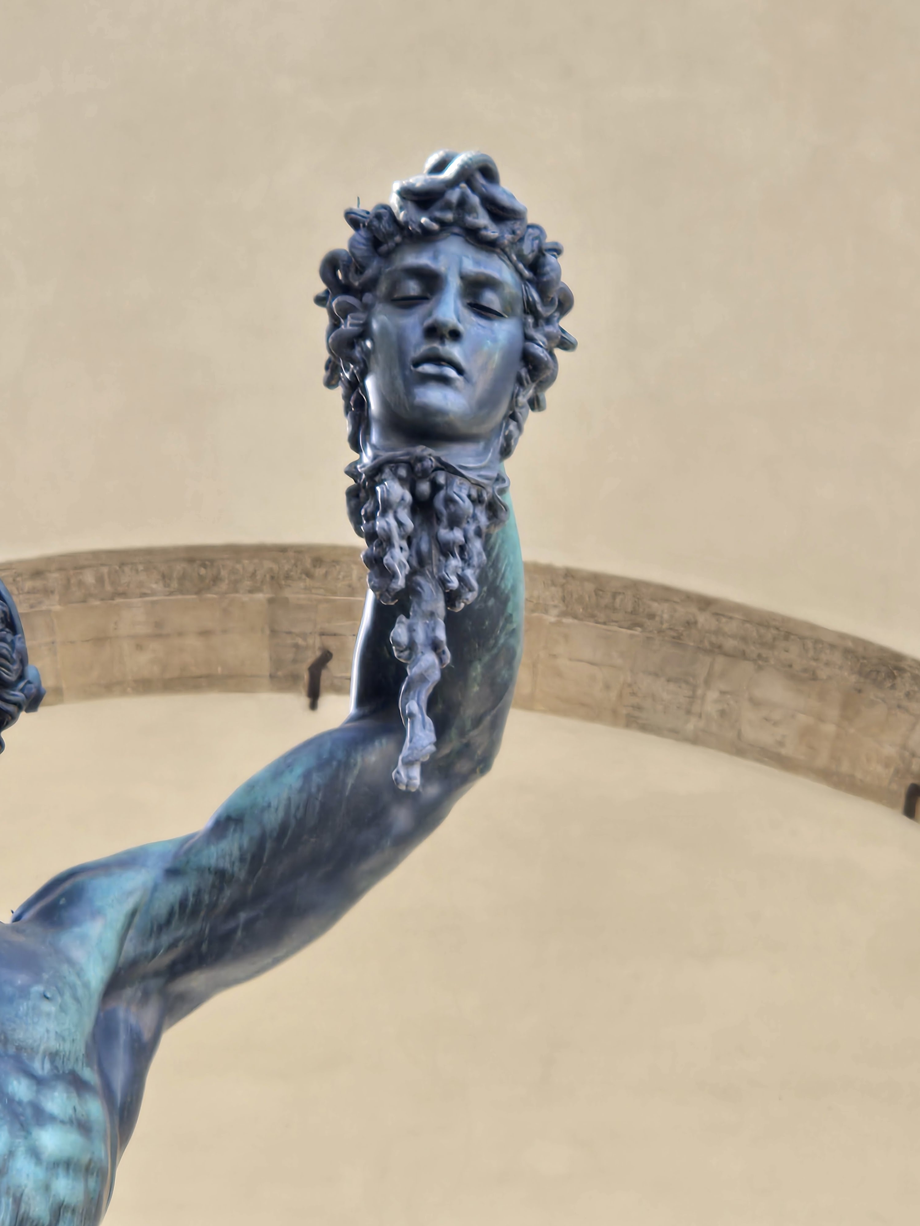
Many of the sculptures are displayed in the Loggia dei Lanzi, an arcade on the south side of the piazza.


Walk past the Loggia, and you find yourself in the long narrow courtyard between two wings of the Uffizi Palace, one of the several homes of the famous (infamous?) Medici family. It's now the home of one of the world's truly great art galleries. 


On the left side, you can see the line of people waiting to be admitted. The line ran the full length of the courtyard in the open, then doubled back behind the pillars on the left and ran most of the way back to the entrance. A perfect example of why advance tickets, preferably with timed admission if possible, are an essential accessory in modern travel.
 
At the end of the courtyard, there's a momentary chance for a unique view of the hills across the river, a view which strongly suggests a Renaissance landscape -- until it's spoiled by the construction crane.
 

Step through the arch and turn right. You are on the north bank of the Arno, walking towards the Ponte Vecchio ("Old Bridge"). This famous bridge is perhaps the only surviving example in Europe of a kind of bridge which could also be found in medieval times in London and Paris, and no doubt many others -- a bridge lined with shops and apartments.


A moment like this definitely calls for a selfie. 
 

The overhangs of the buildings could serve not only for hoisting up goods from boats in the river but also for disposing of certain bodily by-products. It's no wonder that most urban rivers in the Middle Ages were no better than open sewers.

 
Up on the bridge's pedestrian-only roadway, it's easy to believe that you're on  "just another street" until you get to those archways at the middle which give views both upstream and downstream. 


The view downstream is a particularly enticing one, featuring the graceful parabolic arches of the Ponte Santa Trinita. Although the crossing point was far older, this particular bridge was built after a catastrophic flood in 1557. The sponsor? The Medici -- surprise, surprise. In an age when virtually all bridges were built with arches that were circular or segments of circles, these parabolic curves were both startling and elegant. The bridge was destroyed by retreating German troops in 1945, and rebuilt after World War II as an exact duplicate in the exact position as before.


The top level of the Ponte Vecchio houses the famous Vasari Corridor, which joins the Palazzo Vecchio, the Uffizi Palace, and the Pitti Palace on the opposite side of the Arno. It was built to enable the Medici to pass easily and out of public observation between these various buildings, all of which they owned by the mid-1500s. The corridor recently re-opened to the public after a long period of closure.
 
Upon leaving the Ponte Vecchio, you have to walk uphill for a couple of blocks to reach the broad piazza in front of the Palazzo Pitti. At first glance it is far more impressive than the Uffizi as a building. It was left incomplete when the original owner, Luca Pitti, lost his wealth before it was finished. Years later, it was purchased by the Medici and that was when it reached its full stature, becoming their principal residence and housing their vast personal art collection. It is now the biggest single art museum in the city.


The Florence of centuries ago, a city of immense wealth, of Grand Dukes, of Popes and Kings and Queens, and of remarkable artists, can still be seen by visitors. What's the Florence of today like? Well, it certainly has its playful side -- as illustrated by this sign outside a cafe on the Piazza Santa Maria Novella. 


My first thought was "don't bring these things in here" but then, on second thought, what if the real meaning is "leave your drama outside because you're going to encounter things like this if you come in?" Hmm -- I'll just leave this look at a visit to Florence with that question.