This post is the first of a series drawn from a trip to Newfoundland
which my husband Massi and I made way back in 2006.
For me, it was a return trip, but for Massi it was a first visit.
I've tried to confine myself in these blog posts to
For me, it was a return trip, but for Massi it was a first visit.
I've tried to confine myself in these blog posts to
information which will be useful and not outdated by 2019.
Compared to the vast landmass of mainland Canada, the island of Newfoundland doesn't seem terribly large -- at least, on a map. But set out to travel around it, and you'll find that it's very big indeed, and requires a lot of time to do it justice. This is not the place for a 48-hour express tour!
If for no other reason, you'll want to spend a week or more on this island, fondly referred to by resident and expat alike as "the Rock," to get some flavour of a unique and highly developed local language and culture. This culture is the product of centuries of relative isolation -- isolation from ancestral homelands in Ireland, Britain, and France, isolation from the rest of Canada, and isolation of one community from another.
In some respects, Newfoundland's cultural and linguistic heritage bears a passing resemblance to the Maritime provinces to the southwest. By and large, though, "unique" remains the essential adjective. One of the first indications you will see when you get there is the assortment of "intriguing" place names appearing on signs along the highways.


This backwards look at an extended 11-day visit from 13 years ago doesn't do much more than give a nod to the culture, for the simple reason that it's hard to photograph (apart from those signs). I'm going to give you a photo tour of some of the parts of the Rock which we visited, and leave it up to you to go there and immerse yourself in this endlessly fascinating and austerely beautiful place.
Travel to Newfoundland is by air or sea only. Although a road link to the continent of some kind is often discussed, it's never been built because the distance is too great and the volume of traffic too small. For all practical purposes, such a link would likely have to be a tunnel because of the fierce storms, strong tidal currents, and heavy winter ice jams.
The government of Canada operates a year-round vehicle ferry service by Marine Atlantic, from North Sydney in Nova Scotia to Port aux Basques at the southwestern corner of Newfoundland. In summertime, this main route is supplemented by a longer 3-times-weekly run from North Sydney to Argentia, much farther to the east. Vehicle reservations are essential for the Argentia route and very nearly so at peak holiday times and in the summer for Port aux Basques.
If you choose to fly, there are direct flights into the capital of St. John's from Toronto, Ottawa, Montreal, and Halifax. You can also fly direct from Toronto to Deer Lake and Gander. Smaller regional aircraft operate from Halifax and St. John's to Deer Lake, Stephenville, and Gander, while other flights go northwards to St. Anthony and on to Labrador. We flew on a 3-hour nonstop from Toronto to St. John's, and rented a car.
Travel Trivia: The capital of Newfoundland is "St. John's."
The port city in New Brunswick is "Saint John."
Yes, the spelling matters -- obviously.
Don't wind up in the wrong place!
Back in 2006, when we made this trip, unlimited-mileage rental car rates were already common everywhere in North America but the best we could get in Newfoundland was 100 free kilometres per day -- which didn't take us very far. Yes, we put a great many kilometres on that car and yes, the rental company took a great many dollars off our hands. Advance reservations for rental cars are also essential. Or at least "very strongly recommended" -- which in every-day-speak means "essential."
To put that all into perspective, here's a map of the island of Newfoundland.

First question for many people is, "Why doesn't the Trans-Canada Highway go directly from Port aux Basques to St. John's?" The answer is that the south coast is so rugged that many of the communities there have no road access at all, and are dependent on provincial government ferry services to keep them linked to the outside world. These remote communities are the last of the "outports," the isolated coastal fishing villages formerly found all around the shores of Newfoundland and the many adjacent smaller islands. Most of the outport villagers were relocated to larger centres during the 1950s and 1960s to allow for more efficient and reliable delivery of health care, education, and transportation services by the province.
At any rate, the road distance from Port aux Basques to St. John's is 905 kilometres, or about 550 miles, give or take a bit. That long, winding, two-lane road explains the popularity of the summertime ferry to Argentia, a mere 135 kilometres (80 miles) from the capital.
Okay, enough background, already -- let's get rolling with a photo tour of St. John's. This small city sprawls over the steep hills on all sides of the tightly-enclosed harbour. The entrance channel, called The Narrows, is guarded on the north side by Signal Hill. On the summit of Signal Hill is a small stone castle, renowned as the site at which Guglielmo Marconi claimed to have received the first radio signal transmitted wirelessly from Europe.

You can drive all the way to the summit of Signal Hill (if you choose to walk or bike, be warned that it is a stiff climb and usually very windy). From the top, you get a splendid view back over the downtown area of the city.

From the summit you can look down onto the Narrows far below, and imagine how easy it would be to guard this harbour against any seaborne attack. The Narrows is a shooting gallery -- it would be very difficult for gunners on either side to miss an enemy target entering the channel.

After you descend Signal Hill, swing around the north side (the back of the hill, so to speak), and you'll find the quaint old neighbourhood of Quidi Vidi village (that's pronounced "Kiddy Viddy," by the way).

Quaintness of another kind is readily found in the streets of St. John's proper, where many of the old wooden houses -- Victorian and earlier -- are painted in assorted eye-catching colours.

Newfoundland and Labrador Travel photo
As in so many other places in Canada, established religion played a significant role in the life of St. John's in earlier days. Here are pictures of the Anglican cathedral...

...and the imposing Roman Catholic basilica, a major landmark on the city skyline.

St. John's is a city of multiple museums, and one which I could not resist was the museum of railways, housed in the former railway station down near the waterfront.

The Newfoundland Railway was a narrow gauge line which crossed the province along a route more-or-less parallel to that now followed by the Trans-Canada Highway. It was a challenging line to operate, and speeds were necessarily limited by the many curves, stations, and frequent problems with weather. It's no wonder that the tediously slow passenger train from St. John's to Port aux Basques used to rejoice in the ironic nickname of "The Newfie Bullet."
One fascinating exhibit was this 1905 menu. The prices certainly made my eyes pop, but we must recall that many workers were paid a dollar or less per day in 1905.

A relatively new arrival in 2006 was "The Rooms," a sizable cultural and museum space in a brand-new building punctuating the skyline of the hills north of the harbour. Here's a view of the tall, glass-enclosed atrium lobby.

The main tenant of The Rooms is the provincial museum, which contains all kinds of fascinating exhibits and artifacts. A terrace outside the building gives this grandstand view of the harbour, with Signal Hill in the background.

Downtown St. John's rises up quickly and steeply from the edge of the harbour. Walking around in this town certainly gives you a good leg workout. For visitors, the most important street is probably Water Street, parallel to the harbour, and home to an extraordinary variety of pubs and restaurants, many with live entertainment. More spaces are occupied today by chain restaurants, but Water Street is still the easiest place to find multiple choices for good old Newfoundland food and good old Newfoundland music.
If you've arrived in St. John's by air, as we did, you will also find yourself starting your language lessons here. Newfoundland's version of English is so laden with unique words that a sizable, academic dictionary of Newfoundland English has been published. Bring on the fish and brewis, cod tongues and scruncheons, and bakeapple pie!
A quick drive from St. John's to the southeast brings you to Cape Spear. It's not a spectacular sight, by any means, but this flat headland is the most easterly point of North America -- and the next solid land over that horizon is in Europe.

Inland from the rocky shoreline, the grasslands were speckled with beautiful wild flowers.

St. John's lies on the eastern side of the Avalon Peninsula, a sizable chunk of land connected by only a fairly narrow strip to the main island. Here's a map to show the routes we travelled around the Avalon Peninsula, on two day trips out of St. John's.

The Avalon Peninsula got its name from an early settlement south of St. John's, the Colony of Avalon. The name was drawn from the mystical "island beyond the West" of Celtic mythology, but this Avalon proved to be a good deal more intractable than its mythical counterpart. Before long, the leader of the settlers, Baron Baltimore, headed south to more fertile country with memorable historical results -- and his title now graces a major American city in the other colony he sponsored, Maryland.
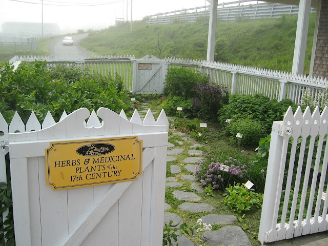
The historic site of the Colony of Avalon just south of Ferryland was a fascinating look at an archaeological project in progress -- with slow and meticulous digging continuing, and reconstruction of historic buildings and facilities underway.

If you've arrived in St. John's by air, as we did, you will also find yourself starting your language lessons here. Newfoundland's version of English is so laden with unique words that a sizable, academic dictionary of Newfoundland English has been published. Bring on the fish and brewis, cod tongues and scruncheons, and bakeapple pie!
A quick drive from St. John's to the southeast brings you to Cape Spear. It's not a spectacular sight, by any means, but this flat headland is the most easterly point of North America -- and the next solid land over that horizon is in Europe.

Inland from the rocky shoreline, the grasslands were speckled with beautiful wild flowers.

St. John's lies on the eastern side of the Avalon Peninsula, a sizable chunk of land connected by only a fairly narrow strip to the main island. Here's a map to show the routes we travelled around the Avalon Peninsula, on two day trips out of St. John's.

The Avalon Peninsula got its name from an early settlement south of St. John's, the Colony of Avalon. The name was drawn from the mystical "island beyond the West" of Celtic mythology, but this Avalon proved to be a good deal more intractable than its mythical counterpart. Before long, the leader of the settlers, Baron Baltimore, headed south to more fertile country with memorable historical results -- and his title now graces a major American city in the other colony he sponsored, Maryland.
The historic site of the Colony of Avalon just south of Ferryland was a fascinating look at an archaeological project in progress -- with slow and meticulous digging continuing, and reconstruction of historic buildings and facilities underway.


Misty days are not uncommon along this eastern coastline. Sometimes, as here at Admiral's Cove, the mist lifts and thins out under the influence of the sun.


Another day was given over to the longer circle tour to Cape St. Mary's and Placentia Bay. First stop was at Colinet, where a turbulent river tumbled over some ancient rock layers.


Continuing south towards Branch, you get a good look at the characteristic Newfoundland landscape features of moorland and the ancient, gnarled, and slow-growing trees of the coastal forests (the trees are often much more twisted and contorted than these ones).

Before the road turns west, you get a distant view of the prominent headland of Branch Head.

Arriving at Cape St. Mary's itself, down a narrow local road, you find a parking lot and a lengthy walking trail out towards the towering coastal cliffs. At this point, my arthritic knees cast a deciding vote and I had to settle for some zoom lens photography from a distance.

You have to look much more closely to make out the multiple little white spatters on those distant sloping rock faces. Those are thousands upon thousands upon thousands of seabird nests, complete with comparable numbers of birds, of many different species. Even at this distance, their squawking cries filled the air and beat on the ears. The zoom lens helps a bit.


By Big iron - Own work, CC BY 2.5, https://commons.wikimedia.org/w/index.php?curid=2543400
After leaving Cape St. Mary's, we continued west and north to Placentia Bay, where a more placid kind of scenic beauty was on display. The entire coastal road along this side of the Peninsula swoops up and down steep hills, with numerous heart-stopping views at every bend and bay. The scenery is very reminiscent of the far more famous Cabot Trail in Nova Scotia.

The Argentia ferry terminal is just a couple of kilometres from Placentia, so the highway from there back to St. John's is a straight, fast drive -- a real contrast to the twisting narrow roads which made up the rest of this circle tour.
In the next post, I'll be taking you north and west across the island to the scenic Long Range mountains which stretch along the entire west coast of the island from south to north -- the northernmost outliers of the Appalachian ranges.
In the next post, I'll be taking you north and west across the island to the scenic Long Range mountains which stretch along the entire west coast of the island from south to north -- the northernmost outliers of the Appalachian ranges.
No comments:
Post a Comment