Perhaps the worst way to wake up in the morning would be to fall into an unexpected hole in the ground and slide all the way to the bottom, 22 metres (72 feet) below.

Fortunately for me, I already knew it was there.
The village of Elora, Ontario, and its two spectacular natural attractions are well-known, at least by name, but not many people will have seen them as I did the other day -- almost empty of people.
Believe me, I'm not complaining!
Due to the combination of a prolonged heat wave, the Covid-19 pandemic, and the early hours of the morning (8:30 to 10:00 am), I had the entire place almost to myself. This is far beyond being merely unusual. On a normal summer morning, Elora would already be well-stocked with tourists -- and on a weekend, so full of cars and visitors that you could easily have to park ten minutes walk or more away from the river.
First word of advice: do not, repeat, do not try to visit Elora on the weekend!
Elora lies about half an hour's drive northwest of Guelph or northeast of Kitchener/Waterloo, Ontario, at the junction of the Grand River and Irvine Creek.

Over the centuries since the end of the last ice age, the Grand River has performed here exactly the same feat as the Niagara River has performed at Niagara Falls. Beginning by falling over a steep rise of limestone rock, the river has gouged its way backwards through the layers of limestone, creating the deep gorge which is the prime scenic attraction here. The village was actually located at the site of the waterfall at the head of the gorge, to take advantage of the water power for driving numerous mills, and the remains of these buildings still surround the cascade to the present day.
To get to the river once you're in the village, just follow the signs. If you get lucky as I did, you may even get one of the eight or so parking spots on the circular driveway right by the entrance gate of Victoria Park.

Inside the gate, just walk straight ahead for one minute into the forest of cedar trees...

...and beyond it you'll come to the rim of the gorge. Not to worry, despite that first photo at the head of this blog post, it's all marked off by a well-maintained modern fence. Turn left along the fence and in a couple of minutes you'll reach this viewpoint overlooking the falls.

The flowerpot rock poised precariously in the middle of the falls is called by an oddly evocative name, the "Tooth of Time."

The Elora formation lacks the hard cap layer of dolostone which allows Niagara Falls to maintain a straight, even crest and vertical drop. If Niagara Falls still exists 50,000 years from now, it will have eaten its way upstream past the end of that hard dolostone layer -- and then it will probably look much like a larger version of Elora's staircase waterfall, cascading over the successive layers of stone on the way down the hill.
Keep following the path past the lookout and in another minute or two you'll emerge from the park onto a quiet residential street. Just at the point where you are about to exit the park, there's a sizable block of eroded stone sitting on the ground. It's all pitted and gouged from the action of running water, so this stone gives you a fair idea of what the rocks under the waterfall may look like when they re-emerge as dry land.

Head back into the park, and go a little past the point where you arrived. You'll find a stone-walled walkway with a few steps running down and out onto a narrow point of land overlooking the gorge. You're standing on top of a sheer crag of rock known as "Lover's Leap," overlooking the junction of the Grand River with Irvine Creek. The name derives from an indigenous ancestral story. This is where you can see that the Elora Gorge is actually two gorges, one for each river, which join at this point. The Irvine Creek gorge is on your right, and easily distinguished by the much smaller waterflow.

The gorge on your left, and in front of you, holds the Grand River, and the bridge carries Wellington County Road 7 across the gorge. This is the main road coming up from Guelph and continuing on north-westwards towards Grey and Bruce Counties.

Beyond that bridge, the succeeding two kilometres of the gorge are within the boundaries of the Elora Conservation Area, a parkland which includes day-use picnic areas, walking trails, and camping facilities which are limited in availability at present. The Conservation Area is also a popular spot for tubing on the river.
For now, though, continue along the rim of the Irvine Creek gorge, and along the way you will see through the fence some striking examples of the trees clinging to the very edge of the gorge. Since this forest was planted all at once after earlier land clearance in the first wave of pioneer settlement, it's plain that the edge of the gorge continues to erode and threaten the livelihood of these stubborn trees.


Close to Lover's Leap there is a stairway down through a steep cleft to the floor of the gorge.
Another marked lookout point allows a view up the Irvine Creek gorge to the elegant concrete arches of the David Street bridge, the key access to Elora from the west. The trail continues north, even after leaving the park, and runs in a straight line behind the backyards of a number of homes right up to David Street.

In the ordinary way of things, at this point in time I would have been making a beeline to a point two kilometres or so upstream from the falls, to the Elora Quarry Conservation Area. This quarry yielded a fair amount of the stone used in building this town, and likely also its neighbour of Fergus. Once disused, it gradually filled with water and became one of the most famous swimming holes of southern Ontario. With three parking lots, picnic tables, changing and washroom facilities, and a beautiful beach between the quarry pool and the Grand River, it's a destination guaranteed to fill up early on pretty much every day through the summer. Sadly, the Conservation Authority has decided to leave it closed this year, presumably due to the difficulty of enforcing social distancing on the not-overly-large beach. Here's an internet aerial photo showing the quarry, which I assume was taken with a drone.

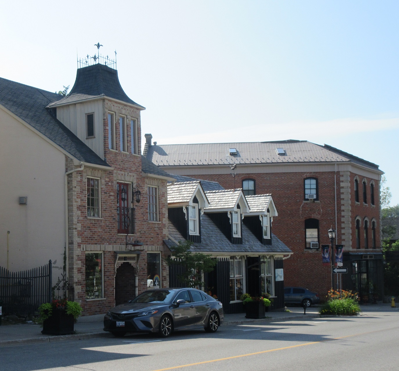
At this point in my visit, I doubled back to the car, and instead of going to the quarry, I headed into town for a look at some of the historic buildings. Nothing proves the strangeness of this visit quite so much as the ready availability of parking spots all up and down the main street.
Downtown Elora hosts an incredible assortment of boutiques of all kinds: clothing stores, jewellery stores, gift shops, food shops, toy shops -- you name it, it's here. And then there are the restaurants, the cafes, the ice cream shops, and on and on. Most amazing in this day and age, there's scarcely a single national brand or chain among them. The real interest to me, though, is the fascinating mix of styles of architecture and methods of construction.


The main street's most eye-catching landmark is the lovingly-restored post office.

A small park next to the post office holds the simple, dignified cenotaph.

At the bottom of the hill, beside the river, are some particularly fine stone buildings, which originally housed the mills and associated storehouses.

The Elora Mill has been repurposed and transformed into a 4-star boutique country inn with a fine restaurant overlooking the river and the falls.
And everywhere in town, there are flowers. In people's gardens, in parks, in numerous planter boxes along the streets, the colours are wonderful. Among the very few people I saw out and about, there was a crew from the municipality going around with a water truck to water all the planters. In fact, the best part of seeing Elora so quiet and devoid of activity was the way that all the flower displays were suddenly visible, not blocked from the eye by rows of parked cars.


Going up to Elora early in the morning, and on a weekday, certainly paid off for me!
No comments:
Post a Comment