If you want to bring your car from mainland Canada to Prince Edward Island, there are two options during spring, summer, and fall: the Confederation Bridge from New Brunswick, or the Northumberland Ferries route from Nova Scotia.
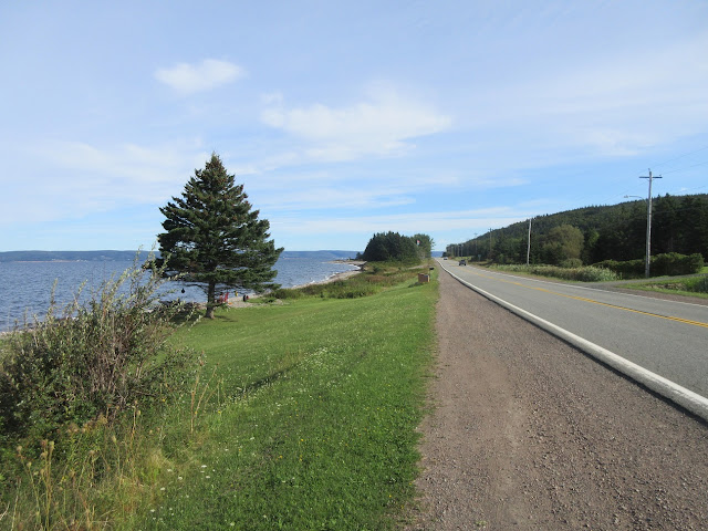
Travelling by car, and coming from Sydney, the last choice was the obvious one for me. But first I had to get there. I decided to travel down Trunk Highway 4 from Sydney to St. Peter's, then 104 to the Causeway and on to the west. It's a long time since I drove that road, and it's in much better condition. A number of the worst bends have been smoothed out over the years, and it's a beautiful drive, especially on a sunny morning with next to no traffic.
All the way along, you get the most beguiling views of the immense Bras d'Or Lake in the centre of Cape Breton Island. The Lake is "sort of" part of the ocean, "sort of" tidal, and "sort of" salt water. All three have to be qualified because it's also fed by numerous freshwater rivers in this mountainous island. There are only two natural outlets to the sea, at the northeast end, and they are not large enough to allow a full, free flow of oceanic water in and out during the cycles of the tides. So the Lake rises and falls, but not nearly as much, and the water isn't and will never be as salty as ocean water. When it looks this beautiful, does it matter?
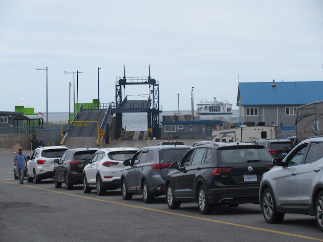
Using this route, I was able to get all the way to the Northumberland Ferries' dock at Caribou, north of New Glasgow and Pictou, in three hours flat from Sydney.
Interlude: Language Lesson: The town of Pictou, site of the first landing of Scottish Highland emigrants in Nova Scotia, is pronounced "Pick-toe." A short distance north, the ferry dock is adjacent to the small village of Caribou -- "Car-i-boo." So logical.
There's an odd quirk about taking your car to the Island which first-timers should certainly know about in advance. It costs exactly $0.00 to take your car over to Prince Edward Island. Instead, they make you pay to leave, either by the bridge or the Northumberland Ferry. And the ferry is somewhat more expensive at $82.00 versus $48.50 for the bridge (rates at time of publication, September 2021). So, smart money says that you take the 75-minute ferry crossing to the Island, and leave via the bridge.
Well, here's the quirk. If you're like me and you want a confirmed, reserved time for the ferry, you can get it -- but only by paying the full $82.00 shot online in advance. If you were then to choose to leave via the bridge, you would have to pay the fee for the bridge as well -- bringing your total to $130.50!
So, it's both ways by ferry. Which is fine with me. Much more relaxing and less driving at both ends of the visit.
Here are a couple of shots of the veteran MV Holiday Island, arriving at the Caribou terminal.
This vessel, built in 1971 (when I was still in high school, yikes!), used to work the Borden-Cape Tormentine route, and became surplus when the bridge opened in 1997 and that ferry route closed. The ship was then transferred to the Caribou-Wood Islands route, and has continued to serve there ever since. Here's a side view of the vessel:
By Qyd - Own work, CC BY-SA 4.0, https://commons.wikimedia.org/w/index.php?curid=3449963And here''s a view of her very different fleetmate, MV Confederation, which joined Northumberland Ferries as a new build in 1993.
By Robert Alfers - Own source, Public Domain, https://commons.wikimedia.org/w/index.php?curid=4508814Together, these two ships replaced a fleet of four older and smaller ferries and provide an efficient service either way in 75 minutes.
On arrival in PEI, you have to pass through a COVID-19 clearance process. Travellers who have not been outside the Atlantic Provinces in the previous 14 days can get pre-cleared on board the ship by presenting the required documents at the information counter.. Those of us who had been outside the Atlantic Provinces had to get a rapid COVID test on arrival. All travellers who are not Island residents have to get a PEI Pass in advance, online.
I had an extra half-hour of waiting time, then, on arrival at Wood Islands. But as the ship glides slowly into this small artificial harbour, you know right away from the reddish soil and rock colours that you're in Prince Edward Island.
Even the seabirds on the pier are a lot more leisurely than their compatriots in more restless and energetic places.
After I had my nose tickled by the shallow swab for the test, I was told to keep my phone switched on and volume turned right up in case I got a call within the next 2 hours from an unknown number. If my test had been "positive," I would have been called and told what to do next. I would not be called if it was negative.
No call.
The hidden benefit of that half-hour wait in the testing queue was that all the ferry traffic had long since dispersed when I finally hit the road to Charlottetown. Right there is when I realized that I was back on Island Time.
Officially, I was still in the Atlantic time zone. Unofficially, since I arrived on Prince Edward Island, I'd been on Island Time. It's a real thing. Island Time is leisurely. People generally seem to be in less of a hurry, more ready to wave someone else across the street or through a door ahead of them. There are a few drivers in a tearing hurry on the roads, but even more who aren't, and suddenly I find that I'm okay with that.
Speaking of the roads, they turn and twist all over the place -- they don't run in the shortest distance to get you from Point A to Point B as fast as possible. And speed limits are more relaxed too. You won't see a speed limit any higher than 90 kilometres an hour on any Island road, and why should you? The worst that can happen is that it takes you a minute or two longer to get wherever you're going.
Thanks to Island Time, it's a leisurely 45-minute drive along Trans-Canada Highway 1 to the Hillsborough Bridge into the city of Charlottetown, with the road meandering back and forth through the farmlands that slope gently down to the sun-smiling waters of the Northumberland Strait.
The bridge: there are two bridges into Charlottetown, across two arms of Charlottetown harbour. To look at the map you'd think this might make a fantastic naval base, but looks are deceiving. Much of that expanse of water is shallow enough to wade in. A dredged channel opens the way for small freighters and small-ish cruise ships to come right into the docks.
So, over the harbour you go on the Hillsborough Bridge and then you're into Charlottetown, the smallest and prettiest provincial capital in Canada. The concept of Island Time really sinks in when you realize that 98% of the roads in Charlottetown are just 2 lanes, and that the 4-way stop sign -- not the traffic signal -- is the # 1 method traffic control in the downtown area.
Even Queen Street, the widest commercial street in the downtown area, is not very big by comparison with Canada's other capitals.
Most of downtown Charlottetown is really just what the name says it is -- a small town by mainland standards, but one filled with all kinds of big-city amenities and services because of its role as largest city in the province and as provincial capital.
Like many small towns in older parts of Canada, Charlottetown is full of older buildings built of brick or stone or wood. There are also a number of modern buildings designed to to fit into the colonial-era streetscape. Intriguing colour choices abound too.
Sometimes the architecture can get downright quirky, as in this building next to the Catholic cathedral, St. Dunstan's. I'm guessing it might be or have been the Bishop's residence. The cathedral itself adopts an austere dignity without reaching a disproportionate size for such a compact city.
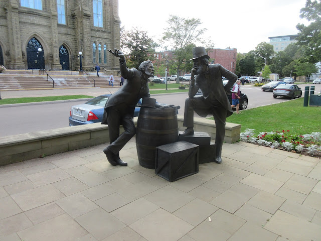
Across from the cathedral, this whimsical sculpture imagines a meeting in 1864, here on Great George Street, between two of the Fathers of Confederation. The two gents in question, one a legislator from New Brunswick, and the other the premier of PEI, were both named John Hamilton Gray.
How appropriate, then, that one of the ferries commissioned by CN for its railway ferry service between New Brunswick and Prince Edward Island (long before the bridge was built) should have been named MV John Hamilton Gray. How often do you get to name one memorial that applies to two people?
The rare modern building which doesn't attempt to disguise its age looks jarringly out of place.
So does the closest thing Charlottetown has to a skyscraper, the 10-storey Delta Prince Edward Hotel, where I stayed. Very comfortable, very modern, and --- jarring.
It reminded me of this classic song lyric:
In Charlottetown, I also had to seek out that essential personal assistant in modern travel: the self-service laundry. I call it the assistant of modern travel because, in the old days, I would most certainly have been travelling with a valet who would manage my wardrobe. Heaven help him if he tried to manage me!
With the laundry done, I set out for the newest portion of Prince Edward Island National Park. This park lies along the north shore of the island which is largely composed of sand beaches and dunes piled up by the weather and waves of the Gulf of St. Lawrence. When I first came here, the park had three main sections in three different areas of sandy shoreline. It was famous for its beaches, dunes, the house which inspired the mythical Green Gables (you just knew that "Anne with an 'e'" had to get in here, didn't you?), and more.
The newest portion, farther east at Greenwich, is different. Although it, too, has its beach, the focus is on other matters -- the preservation of the unique natural landscape and environment in collaboration with the Mi'qmaw whose traditional land it occupies. At one time, the land was farmed, but the farm is long gone and nature is engaging in the slow and steady process of reclaiming the land for her own.
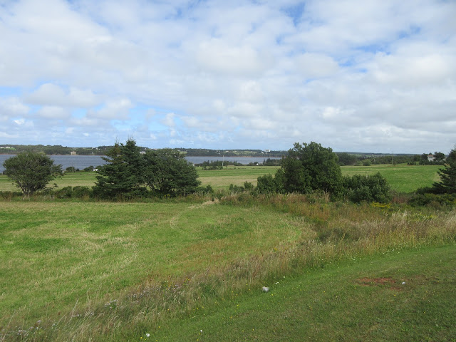
It's about a 50-minute drive east of town to get to the park. You drive all the way east on highway 2 to St. Peter's, getting this view of St. Peter's Bay as you near that village. It's a classic Island view, the fields and forests sloping gently downhill to the water's edge.
At St. Peter's, just follow the markers for the National Park and you'll drive back west along the north shore of the Bay on highway 313 until you come to the parking lot at the end of the road. The south side of the lot gives access to a smooth, gravelled trail which gives easy walking along the level land.
Some parts run through trees as shown here, and some through open areas that were once farm fields. In due time (20 minutes or so), you come to a junction. Take the trail on your right to the north and you plunge right into a forest whose character keeps changing dramatically from one minute of walking to the next.
As the forest starts to thin out, near the edge, you find the sandy bottom in one clearing all covered by these grey lichens.
Then you come out of the woods and you're on the edge of a sizable pond. Here's an aerial photo from a signboard in the park -- picture taken in 1998 when the land had just been given over to the Park.
The Greenwich Dunes are, by a wide margin, the highest dunes on the island. The park has built a combination wooden walkway and floating bridge to span the marshlands and the pond and so make the dunes accessible.
As you cross the bridge, the huge dunes come into view off to your left and ahead of you.
There is one designated trail leading up to a viewpoint atop one of the dunes, but I took a pass on that as I was pretty sure my knees weren't up to tackling a "dune ladder."
The best part of the expedition to Greenwich was that it was not, unlike the better known Cavendish and Brackley portions of the Park, overrun with visitors. In fact, my hour-long walk here was another perfect example of life on Island Time.
To wrap up: the updated map of my travels, up to and including Prince Edward Island.


So nice to be reminded of the pleasures of life on island time on beautiful P.E.I. which I experienced in 2015.
ReplyDelete